Richmond Hill - Oak Ridges (Regatta Ave)
Meet at parking lot on the north side of Regatta Ave, west off Yonge St, 4 stop lights north of King Rd.
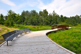
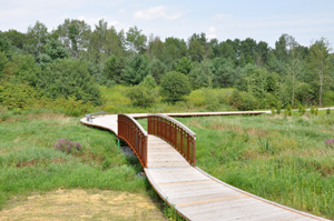
Community trails on prize-winning boardwalks.
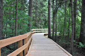
The East Humber Trail is a recreational walking & hiking trail. It passes through a variety of vegetation communities and landform features typical of those found on the Oak Ridges Moraine. The lands surrounding the trail are comprised of old fields in various stages of succession, with some extensive woody vegetation, as well as forested areas ranging from early successional to mature mixed forests. The trail also passes through wetland/wet meadow communities that are located within the floodplain of the East Humber River which bisects the property diagonally from the southeast to the northwest. These lands provide a diversity of habitats for many wildlife species, particularly birds, including the Black-Billed Cuckoo, Yellow-Billed Cuckoo, Ring-Necked Pheasant and Red-Breasted Nuthatch, which are all uncommon in the Greater Toronto Area.
Please note that East Humber Trail is intended for walking/hiking/jogging only. Cycling is not recommended.
Some of the key design features of the trail include:
- A trail width of 1.5 -2.4 metres
- Limestone screening and woodchip surfacing
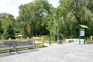
- Waste receptacles at all trailheads
- Numerous Armourstone seats and benches
- Three boardwalks
- Four bridges