Oshawa - Harmony Creek (Donevan Rec Ctr.)
Meet at Donevan Rec Ctr. parking lot, 171 Harmony Road South (north of 401).
Oshawa Trails
Oshawa's Trail system totals almost 27 km of paved surface that provides citizens and visitors with opportunities for physical activity such as walking, running, cycling, rollerblading or bird watching. A safe and environmentally friendly way of getting to and from work, school, shopping, or a nearby park, the trails are a great place to gather and enjoy the outdoors with friends and family.
Trail Characteristics and Accessibility
The City of Oshawa constructs all new trails to meet accessibility standards. Older established portions of the trails may have steep slopes, sharp turns and unprotected edges with close proximity to the lake or creek and may be considered as a potential obstacle for some users. Some portions are prone to seasonal flooding and freezing. On-road portions of the trail require the user to maneuver along and across areas with vehicular traffic.
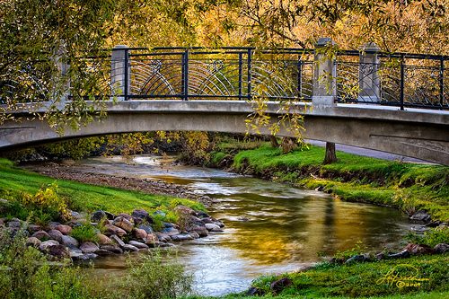
Harmony Creek Trail - 4 km

This paved trail is surrounded by lush vegetation and meanders through the valley along Harmony Creek. The natural surroundings of the valley provides a migration corridor for wildlife and naturalization projects have helped improve water
quality. The trail has a number of steep slopes and edges with close proximity to the creek. Caution is advised when accessing and maneuvering the trail.
Oshawa Trails Brochure
Information Source: Oshawa website
171 Harmony Rd S
Oshawa, Ontario ON L1H
Canada